Richard III: Discovery and identification
Grey Friars in old maps and plans
Historic maps of Leicester were an invaluable source of information for pinpointing the potential location of the Grey Friars, charting how that area of the town has changed over the last 400 years.
17th-century maps
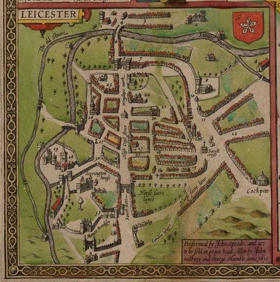
The first maps of Leicester date to the early 17th century, but these show too little detail to be of much use. One map, produced by John Speed in 1610, even shows Grey Friars in the wrong place, mislabelling the Dominican friary of Black Friars in the town’s north-west quarter rather than the real site in the town’s south-east quarter which was left unmarked.
18th-century maps
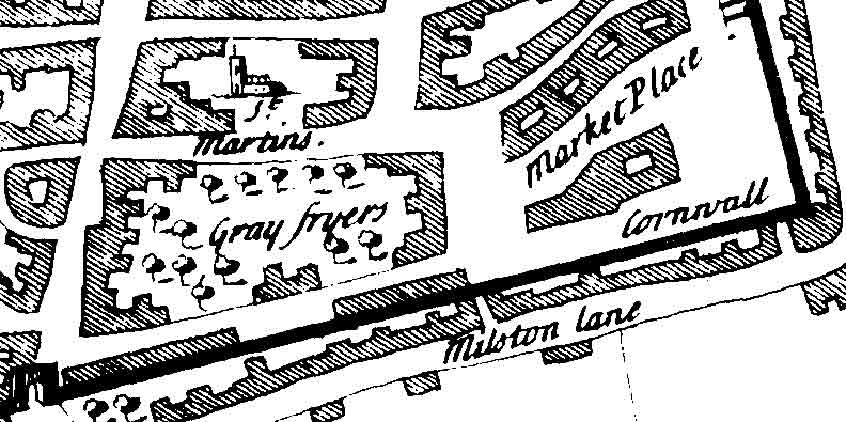
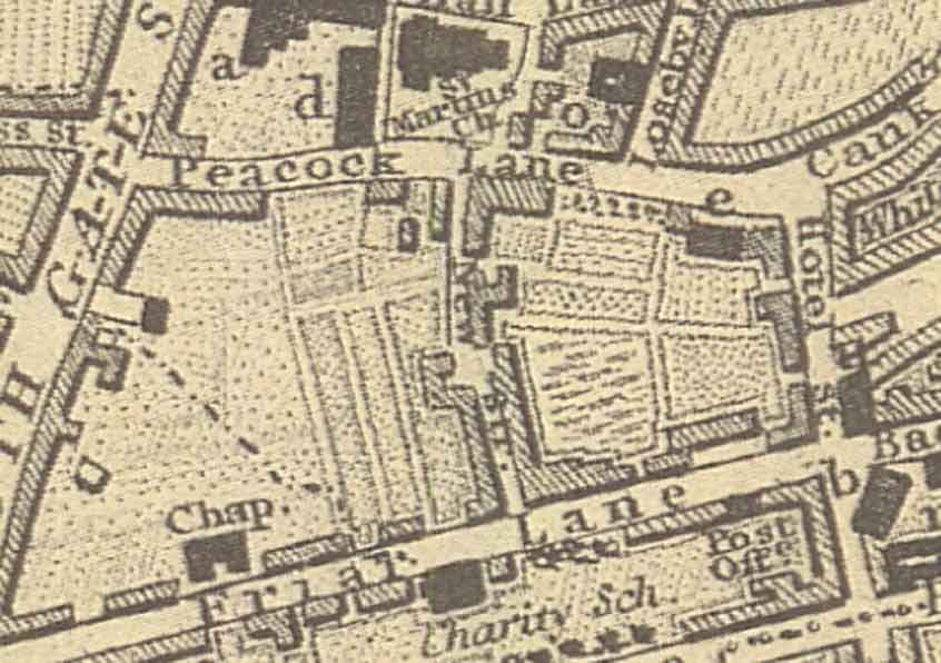
By the early 18th century cartographic techniques were becoming more refined. William Stukeley’s map of Leicester, produced in 1724, correctly marks ‘Gray Fryers’ in a block of land south of St Martin’s church but lacks detail to be more precise. Thomas Robert’s map of the town, dated 1741, shows accurate detail of the Grey Friars area, clearly depicting a large enclosure labelled ‘Gray Fryers’, which is undoubtedly the friary precinct.
Although Roberts’ map dates to 200 years after the friary, it is believed that the boundaries remained unchanged (a commonplace occurrence) when Robert Herrick built his mansion house here. Although Highcross Street to the west and (what is now) Hotel Street to the east are shown as having built-up frontages, there are comparatively few buildings on the Friar Lane and Peacock Lane/St Martins frontages. Much of the area of the former friary precinct and later post-dissolution mansion seems to be occupied by orchards and gardens, some of the latter with apparently formal layouts. A rather sketchy group of structures close to the Friar Lane frontage (immediately north of the street name on the map) represent the Herrick mansion and perhaps a surviving medieval gateway or gatehouse.
19th-century maps
In the 19th century, Thomas Combe’s map of 1804 showed no interior detail of the Grey Friars area but was the first to show New Street bisecting the site. Another map, produced by John Fowler in 1828 showed more detail, with buildings appearing along New Street and a chapel on Friar Lane; whilst away from the street frontages most of the area is still shown as garden plots or open land.
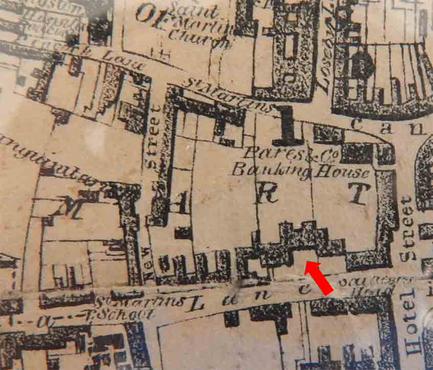
Burton’s town plan of 1844 clearly shows the subdivision of the Grey Friars area into properties extending off Friar Lane and Peacock Lane. Pare & Co. Banking House is labelled on St Martin’s and importantly, Robert Herrick’s mansion can still be seen set back from Friar Lane.
Late 19th-century and 20th-century maps
It was not until the late 19th century, with the publication of the first edition 1:500 Ordnance Survey town plan in 1887 that real detail of the Grey Friars area becomes available. By then, buildings largely covered the whole of the Grey Friars site with areas away from the streets all shown as gardens.
Contemporary with the Ordnance Survey are a series of plans for the city produced by Charles Goad, civil engineers between the 1880s and the 1950s. These were published to help insurance companies assess the premium rates of properties. The surveys indicate building proximity, materials, occupancy, and water sources. Often, they state the number of stories in each building and whether or not they were cellared. Goad plans of the Grey Friars area are available between 1892 and 1944.
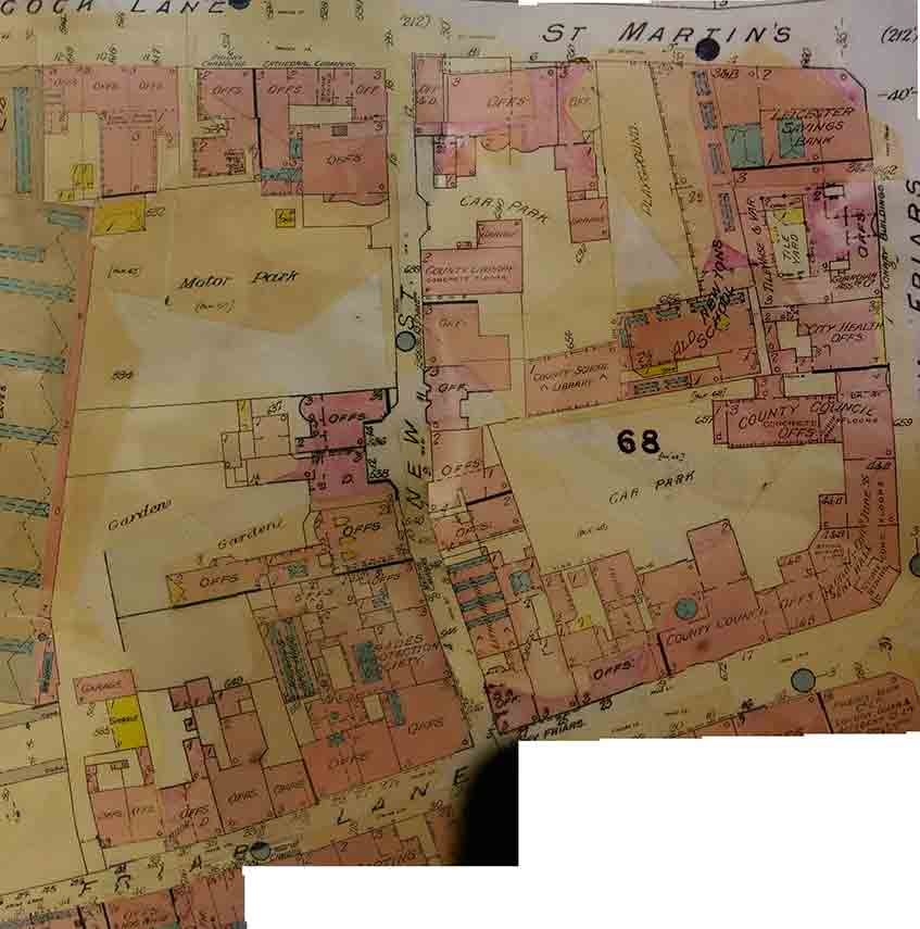
These late 19th and early 20th century maps chart the continued development of the Grey Friars area. Notable additions include extensions to the Alderman Newton’s School between 1892 and 1915, construction of the Southgates bus station between 1923 and 1930, development of the County Council offices between 1923 and 1944, and the change in land-use from ‘garden’ to ‘car park’ or ‘motor park’ for many of the open area between 1923 and 1938.
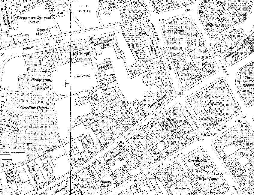
The 1955 25” OS map marked for the first time ‘Franciscan friary (site of)’ in a car park to the west of New Street. The legend was repeated on the 1969 edition but was dropped from the 1970s onwards.
Maps between 1888 and 1955 show numerous small outbuildings in the area of ‘garden’/’car park’ in which the project focused. Of particular note, the 1938 Goad plan showed a single-story library extending west across the car park from the Alderman Newton’s School; whilst one of the out-buildings off the back of 6a St Martin’s was shown to be a garage. These had all gone by 1944. The outbuildings to the rear of 6a St Martin’s ultimately proved to be built over Richard III’s grave. A building plan for an extension to the County Council offices along St Martin’s, dated 26 July 1934, listed them as a W.C. and coal store which were to be replaced by a garage and other storerooms.