People
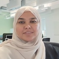
Dr Khunsa Fatima
Post Doctorate Research Associate

Profile
My research focuses on developing advanced automated tools for wetland mapping, integrating Earth Observation data and Artificial Intelligence to enhance the accuracy and efficiency of predicting wetland methane emissions, thereby contributing to more precise climate change predictions. Currently, I work as a Research Associate in wetland monitoring at the National Centre for Earth Observation (NCEO), based at Space Park Leicester, and I am a member of the Earth Observation Science Group within the School of Pyhsical and Astronomy. My role is supported by Dr Robert Parker's UKRI Future Leader Fellowship, and my work will contribute to the development of 'The First Environmental Digital Twin dedicated to understanding Tropical Wetland Methane Emission for Improved Prediction of Climate Change'.
I did my Ph.D. from Newcastle University, where my research focused on 'Ground-based Sensors Technologies for Tree Health Assessment'. My work involved training deep learning models for semantic segmentation of tree image and developing automated workflows for assessing biophysical tree health metric. I hold an MS Remote Sensing and GIS degree from National University of Sciences and Technology (NUST) Pakistan and an MSc Space Science degree from University of the Punjab Pakistan. I have seven years of experience as a Lecturer in Remote Sensing at NUST Pakistan. Before transitioning to academia, I worked with humanitarian organisations, including the United Nations Office for the Coordination of Humanitarian Affairs (UNOCHA), the International Committee of the Red Cross (ICRC), as well as the R&D organisation National Engineering Services of Pakistan (NESPAK).
Publications
Maqsood, U., Tahir, A., Fatima, K., and Rehman, A. (Jul 2020). Interpreting Rescue Vehicles Patterns using Geo-visual Analytics for Spatio-Temporal Resource Allocation. Arabian Journal of Geosciences. DOI: 10.1007/s12517-020-05643-w
Azhar, R., Zeeshan, M., Fatima, K. (Jul 2019). Crop residue open field burning in Pakistan; multi-year high spatial resolution emission inventory for 2000-2014. Atmospheric Environment. DOI: 10.1016/j.atmosenv.2019.03.031
Rehman, A.U., Chishtie, F., Qazi, W. A., Ghuffar, S., Shahid, I., & Fatima, K. (Dec 2018). Evaluation of 3-Hourly TMPA Rainfall Products Using Telemetric Rain Gauge Observations at Lai Nullah Basin in Islamabad, Pakistan. Remote Sensing, 10(12), p.2040. DOI: 10.3390/rs10122040
Rehman, A.U., Chishtie, F., Qazi, W. A., Ghuffar, S., Shahid, I., & Fatima, K. (Oct 2018). Validation of TRMM 3B42 Rainfall Product at Lai Nullah Basin, Islamabad, Pakistan. Journal of Space Technology, 8(1), 59-64
Naeem, S., Cao, C., Fatima, K., Najmuddin, O. and Acharya, B. (Apr 2018). Landscape Greening Policies-based Land Use/Land Cover Simulation for Beijing and Islamabad—An Implication of Sustainable Urban Ecosystems. Sustainability, 10(4), p.1049. DOI: 10.3390/su10041049
Fatima, K., Khan Khattak, M., Kausar, A., Toqeer, M., Haider, N. and Rehman, A. (Oct 2017). Minerals identification and mapping using ASTER satellite image. Journal of Applied Remote Sensing, 11(04), p.1. DOI: 10.1117/1.JRS.11.046006
Fatima, K., Khattak, U. and Kausar, A. (2013). Selection of Appropriate Classification Technique for Lithological Mapping of Gali Jagir area, Pakistan. World Academy of Science, Engineering, and Technology. Melbourne, Australia: DOI: scholar.waset.org/1999.6/9996817
Fatima, K. and Shaheen, A. (2008). Estimation of Surface Runoff for Tarbella reservoir. 2nd International Conference of Advances in Space Technologies. Islamabad, Pakistan. DOI: 10.1109/ICAST.2008.4747695
Saeed, U., Fatima, K., Gillani, H., Daud, A. and Ashraf, S. (2008). Selection of Appropriate Classification Technique for Coastal Biomass Mapping using High-and-Low Resolution Dataset. 2nd International Conference of Advances in Space Technologies. Islamabad, Pakistan. DOI: 10.1109/ICAST.2008.4747691
Teaching
During my previous role as a lecturer (2012-2019) at the National University of Sciences and Technology (NUST) Pakistan, I taught following udergraduate courses:
- Advanced Remote Sensing and Image Processing
- Geo-Informatics
- Introductiont to Geographical Information Systems
- Computer Aided GI Design
Awards
- Runner Up in the 3MT (Three Minute Thesis) Regional Competition among Durham, Northumberland, and Newcastle Universities (July 2021)
- Runner Up Awards in 3MT for Newcastle University Competition (May 2021)
- Best 2nd Year Poster certificate at Fera Science Conference 2020 (Nov 2020)
- EuroSDR Scholarship for E-Learning courses on LiDAR technologies (Feb - Jun 2022)
- President’s Gold Medalist by securing 1st position in MS Remote Sensing & GIS (2011)
- National University of Sciences and Technology Pakistan Merit Scholarship (2007 – 09)
- Gold Medalist by securing 1st position in M.Sc. Space Science (2009)
- Chief Minister’s Merit Scholarship during MSc Space Science (2004)
Conferences
- Organised and managed Newcastle University Postgraduate Research Conference (2021)
- Chaired session at School Postgraduate Research Conference (2022), facilitating discussions and time management.
- Delivered findings at major conferences, including ForestSAT Berlin (Aug 2022), SNES PGR and SAgE PGR Conferences at Newcastle University (Jun 2020, Jun 2021, Jun 2022), and IAFRI Science Symposium Norfolk (Nov 2020).
- Showcased research at posters at International Plant Health Conference London (Sep 2022), UK National Earth Observation Conference Leicester (Sep 2022), and Treescapes (Jul 2021).