British-built satellite launches to map Earth’s forests in 3D for the first time with Leicester expertise
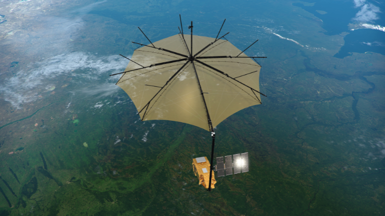
The Biomass satellite over a rainforest (ESA/ATG medialab)
A satellite developed by British academics and engineers, including expertise from the University of Leicester and the National Centre for Earth Observation (NCEO) based at Space Park Leicester, is set to become the first in the world to measure accurately the condition and carbon mass of the Earth’s forests from space.
The work will be crucial to helping us understand how tropical forests in particular are changing so we can protect future generations from climate breakdown and accelerate the transition to net zero. From the Amazon to Indonesia, these remote dense habitats store around 70% of the world’s forest carbon and previous satellites have not been able to accurately and confidently quantify this component. BIOMASS is a true Earth Explorer.
The BIOMASS satellite successfully launched from Kourou in French Guiana today (Tuesday 29 April, 10.15am GMT), as it made its way to orbit at approximately 650km above the Earth’s surface.
From conception to construction, the satellite has been built in the UK capitalising on our industrial and academic expertise in space technology while opening up new opportunities to attract future backing from global investors watching its landmark launch on 29 April.Colleagues across Europe are also heavily involved through the international science team, led by Professor Shaun Quegan of NCEO, and the contributions of European technologies supplied to the UK team at Airbus.
Throughout construction, BIOMASS has supported approximately 250 highly skilled jobs at Airbus UK, in Stevenage, where it was manufactured, supporting the local economy and bolstering the UK’s 52,000 strong space workforce.
The Biomass satellite launched from Europe’s spaceport in Kourou, French Guiana. Since 2016, the UK has won almost 91 million Euros in contracts for Biomass through its membership of the European Space Agency (ESA) which has led the development of the satellite and enabled BIOMASS to have a supporting international team.
Conceived by University of Sheffield and NCEO academic Professor Shaun Quegan, it is a hallmark of British innovation, facilitating jobs in everything from design and development to assembly integration and test. The satellite will create a 3D map of tropical forests after 17 months, then new (non-3D) maps every 9 months for the rest of the 5-year mission, providing insights normally hidden from human sight because of the difficulty in accessing these environments.
Its revolutionary technology will help scientists capture vital data on the changes to carbon in forests as ecosystems are increasingly impacted by deforestation.
Professor Heiko Balzter and Dr Nezha Acil from the University of Leicester and NCEO will be developing approaches to estimate aboveground biomass from the Biomass instrument as part of NCEO's national capability, strategic research activities funded by the Natural Environment Research Council (NERC) project and in partnership with ESA. They hope to reach a better representation of biomass across different regions, notably in the densely forested tropics, as the radar frequency that the Biomass sensor will use is more suitable for measuring the deeper structures of forests.
Professor Balzter, from the University of Leicester Institute for Environmental Futures, said: “BIOMASS is one of the most exciting satellite missions launched during my research career. The P-band SAR is pushing the boundaries of remote sensing technology. The images will no doubt transform our understanding of global forest carbon stocks and their changes over time.”
Professor John Remedios, Executive Director of the National Centre for Earth Observation said: “The BIOMASS mission will have a huge impact scientifically and in understanding our global inter-connectedness. What happens in the tropical forests directly affects the atmosphere where we live through carbon dioxide concentrations and long-term changes in our weather. Data from the BIOMASS mission will give us a true measure of the carbon regulation that forests provide, knowledge of the trajectories of these forests at a time of rapid change and an assessment of their vulnerabilities to climatic tipping points.”
Both deforestation, which releases carbon dioxide, and forest growth, which soaks up carbon dioxide from the atmosphere, are crucial parts of climate change.
Data on the biomass of tropical forests is very limited because they are difficult to access.
The BIOMASS satellite will be able to penetrate cloud cover and measure forest biomass more accurately than any current technology, which only see the top of the canopy. The unique P-band wavelength results in signals which are dominated by the return from trunks and branches which constitute the bulk of living carbon. By providing better data it will help create a more accurate global carbon budget and better understanding of carbon sinks and sources which will help in developing and implementing effective strategies to achieve net-zero goals.
Observations will also lead to better insight into the rates of habitat loss and, as a result, the effect this may have on biodiversity in the forest environment.
Shaun Quegan, University of Sheffield’s Professor, NCEO staff member, and lead proposer of the mission concept to the European Space Agency, said: “It’s been a privilege to have led the team in the development of a pioneering mission that will revolutionise our understanding of the volume of carbon held in the most impenetrable tropical rainforests on the planet and, crucially, how this is changing over time. Our research has solved critical operational scientific problems in constructing the Biomass satellite.
“Conceived and built in the UK, Biomass is a brilliant example of what we can achieve in collaboration with our partners in industry and academia. The mission is the culmination of decades of highly innovative work in partnership with some of the best scientists in Europe and the US.”
Minister for Space Sir Chris Bryant said: “The Biomass mission showcases British ingenuity at its very best, from conception in Sheffield to construction in Stevenage.
“Britain is not only stepping to the forefront of the space industry, but of global climate action too.
“Contributing to such great extent to a European mission set to deliver vital global results is testament to the UK’s industrial and academic expertise in space technology and will attract global investment into our vibrant space ecosystem, helping us boost growth and deliver our Plan for Change.”
Dr Paul Bate, CEO of the UK Space Agency said: “The Biomass satellite represents a major leap forward in our ability to understand Earth’s carbon cycle. By mapping the world’s forests from space in unprecedented detail, it will provide critical insights into how our planet is responding to climate change — helping scientists, policymakers, and conservationists take informed action. We’re proud of the leading role the UK has played in this important mission.”
Climate Minister, Kerry McCarthy, said: “The UK is back in the business of climate leadership and protecting the world’s forests through emerging and cutting-edge technologies is crucial to tackling the climate crisis.
“This innovative tool shows how climate action attract investment in the UK, driving growth as part of our Plan for Change.”